Peddars Way in a Day
- Jun 10, 2022
- 2 min read
Updated: Jun 11, 2022
Described as a 'Neolithic M1', the Peddars Way is an ancient trackway that loosely follows an old Roman Road from Knettishall Heath near Thetford, to Holme-next-the-Sea on the Norfolk Coast. A large percentage of its 74km length is off-road with tarmac detours for sections of trail classified as public footpaths and what it lacks in any sort of elevation, it makes up for in long, straight gravel paths allowing a rider to cover considerable ground in a short sitting.
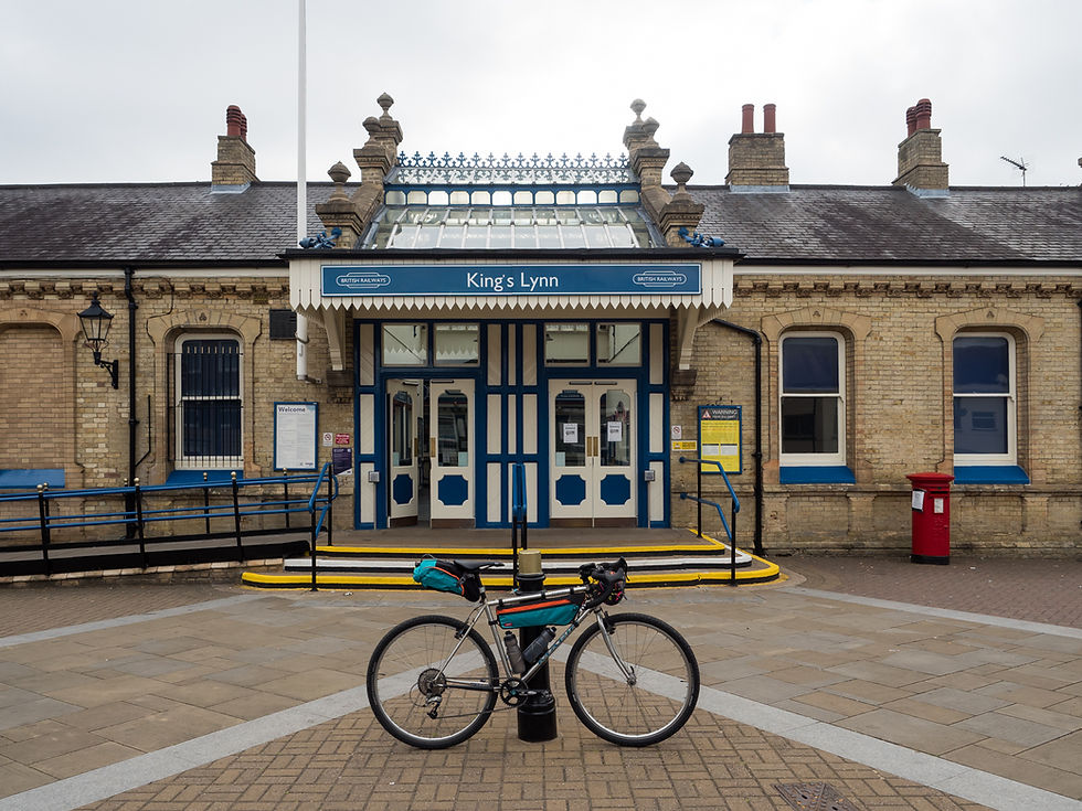
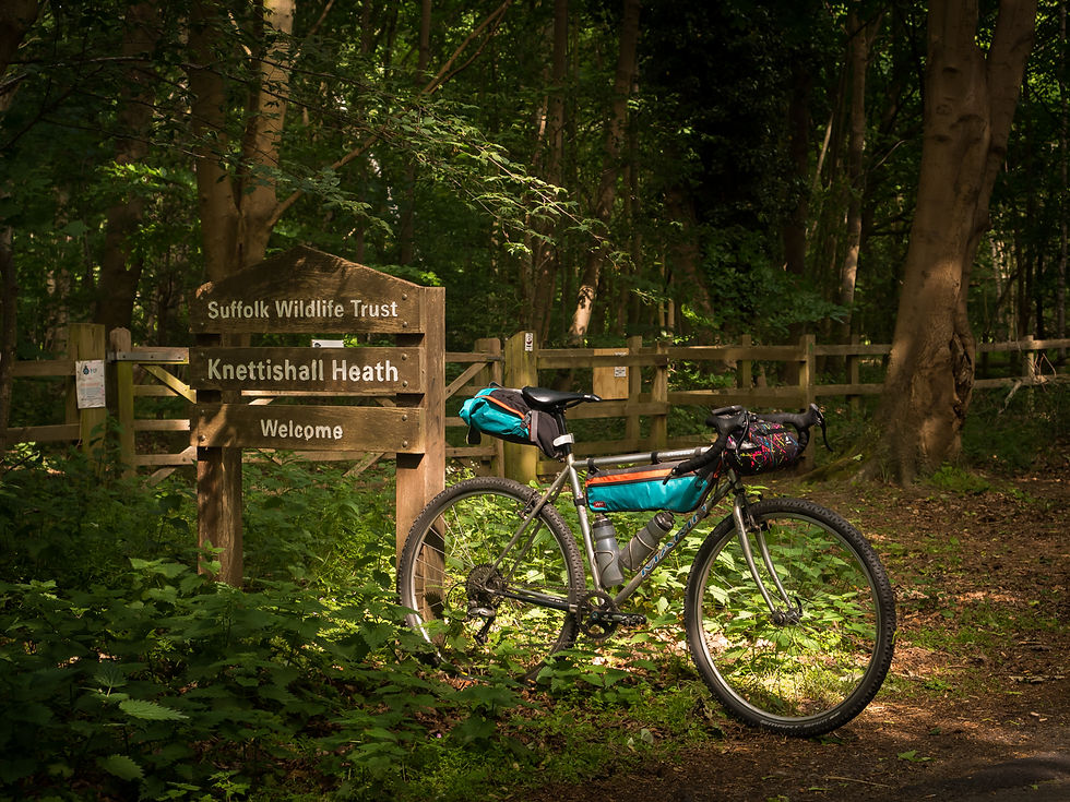
My companion for the ride would be my mid-90’s Marin Stinson, a rescued 700c steel hybrid ‘Dad Bike’ that was found abandoned near my apartment. Rebuilt into the drop-bar gravel bike seen here, it rides incredibly well and would prove to be perfect for the terrain I was to encounter. With an early start, I began the journey from King’s Lynn railway station, making the 30km ride north east to reach the coast and Peddars Way trail head at Holme-next-to-Sea. From there, I would travel south to Knettishall Heath (via Castle Acre) and then on to Thetford to train home to Cambridge.
The first leg of the ride was quite straight forward with it being all tarmac from King's Lynn to Holme-next-the-Sea via Sandringham Estate. Despite the laden bike, I found my rhythm and was even able to outpace a number of road cyclists on their Saturday morning casual ride. After a brief pause in the sand dunes at Holme-next-the-Sea, I officially joined the Peddars Way at the A149.


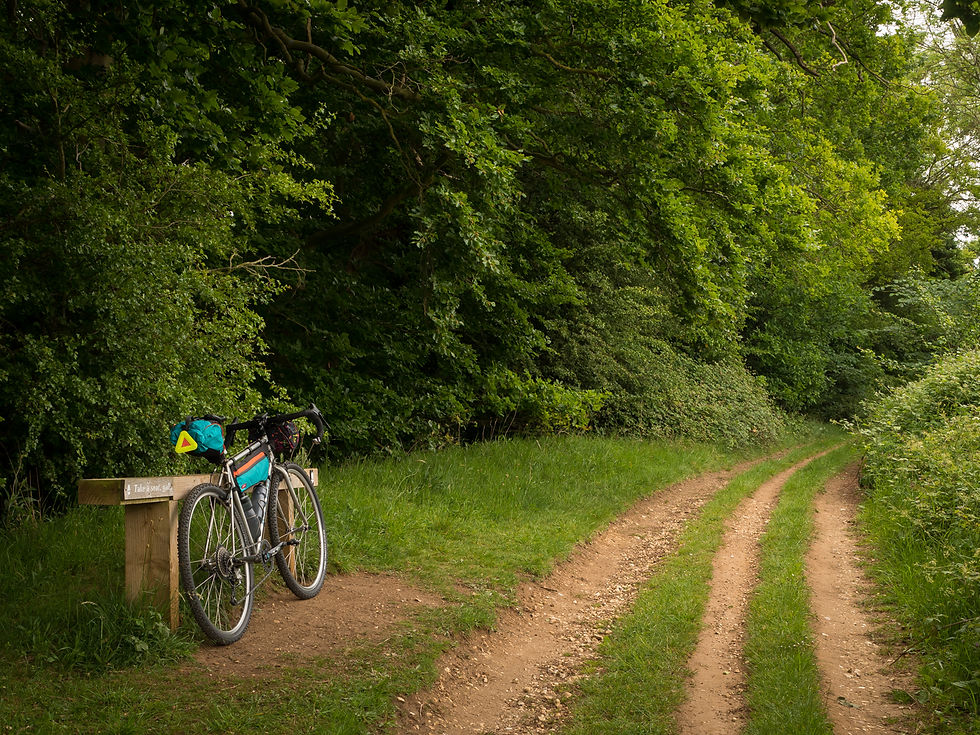
The route was quite varied, from farm tracks and quiet country lane ways, to long straight tunnels of green. Some of the double-track was quite heavily rutted so care had to be taken to ensure that the front wheel didn't get caught in said ruts. I found this stretch the most taxing, especially on the wrists, thus found myself dialling back the pace, in order to preset some comfort.
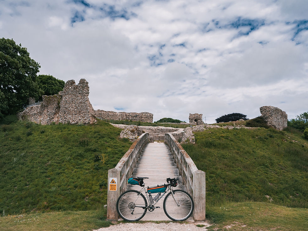
The rough 'half way mark' was Castle Acre which proved to be an excellent lunch stop. This tranquil little village is a survived example of a Norman planned settlement and includes a well preserved motte-and-baiely castle, two stone gatehouses and one of the best-preserved monastic sites in England, Castle Acre Priory.
Fed and watered, I pressed on. The next phase of the ride followed a series of quite lanes and forestry roads through plantations and heathland. I particularly enjoyed a short, fast stretch of hard pack as the trail skirted around the Stanford Training Ground. The trail continues to be well signposted however I must sadly report I cycled a short section of the footpath by accident after apparently missing the cycle route detour, south of Roudham Heath. I was also running low on water at this point; a future project I think will be to add an additional cage under the down tube near the bottom bracket to carry a third bottle for these long days in the saddle.


Before I knew it, I was rolling into Knettisall Heath in the dreamy afternoon light, 130km deep with a big grin on my face.
For more information (and an interactive map of the route), see the following link on the Norfolk City Council website.
Thanks for reading!


Comments